Entrance and plot
Request the project’s written location and suitable entrance, rather than just a district name.
The Waterway Developments · Location
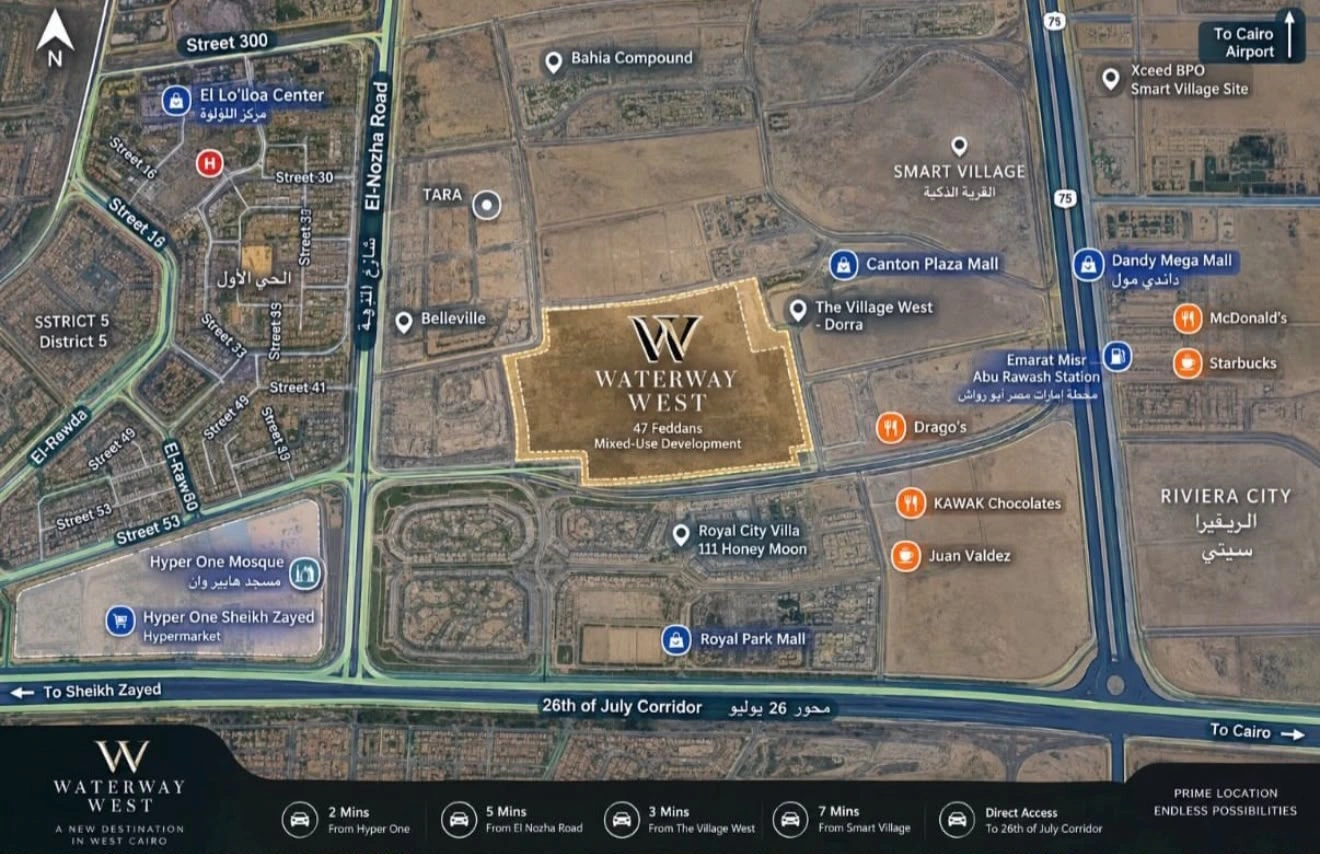
Explore the supplied location illustration and its relationship to the 26th of July Corridor, El Nozha Road and West Cairo landmarks. Open the map for a closer look.
Area context
The illustration shows the project in relation to the 26th of July Corridor and El Nozha Road, with landmarks including Hyper One, Smart Village and The Village West. Open the full view to read roads and directions clearly.
When arranging a visit, request the meeting point and suitable entrance. Journey times depend on your starting point, timing and route.
Request the project’s written location and suitable entrance, rather than just a district name.
Compare work, family and services at the times you normally travel.
Confirm access, the type of viewing and construction status before agreeing a visit.
Your next step
Prices, availability, payment terms and handover dates require current confirmation for the specific unit. These details and images introduce the project; they are not a sales offer.